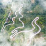
Heard that Ha Giang is famous for its unreal beauty and the warmness from the local customs and people but have no idea of where to go and what it has to offer? Below is some piece of information about Ha Giang Loop Map that you can take for your next travel plan.
1. WHERE IS HA GIANG LOOP?
2. HA GIANG LOOP MAP.
This map below will help you know more about Ha Giang Loop.
-
Ha Giang City – Tam Son Town (46 km):
Ha Giang City is kind of a transit place to access a bunch of guest houses or hostels before and after the trip. Some attractions closeby such as Nui Cam Mountain or Thon Tha village of Tay people are also well worth. From there to Tam Son Town at the end of Quan Ba Pass, you sta
-
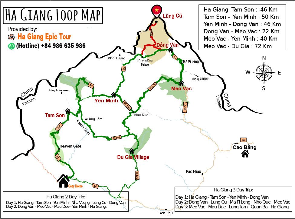
Ha Giang loop map rt to feel the differences between the city and higher places with rustic and chilling vibes through Nam Dam Village, Twin Mountian and Lung Khuy Cave. There is always a large fair for 22 ethnic minorities on Saturdays.
-
Tam Son – Yen Minh (50 km):
From the top of the Heaven Gate, a panoramic view of Tam Son town appears. It seems like traces of cloud in the sky with vast pine forests spreading on numerous slopes to Yen Minh town as we across Can Ty Slope. Yen Minh Town is an ideal place for travellers to have lunch and relax on the way.
-
Yen Minh – Dong Van (46 km):
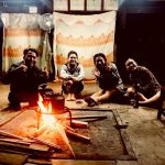
Conquering the beautifully captivating Tham Ma and Chin Khoanh Pass along with climate changes is really awesome after that.Visit the Lung Cam Culture and Tourism Village, where the scenery is embellished by colourful dresses and flowers on shoulders of the local people. You may get useful insights into local architecture and history as witnessing the King H’Mong Mansion and ancient houses in Pho Bang. Lung Cu Flagpole, a monument to mark the northernmost point, is a great spot to chill out, too! Isolated from less busy areas, Dong Van Ancient Town is the busiest spot at night time.The Old Town is also the home of thousands of inhabitants and lies many stories for more than 100 years. Various superb special dishes here like thắng cố are available to cater you.
-
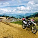
Dong Van – Meo Vac (22 km) – Du Gia (72 km):
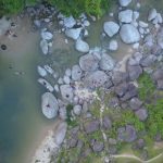
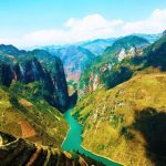
Ma Pi Leng Pass on the Happy Road of QL4C at an altitude of 1500 meters above sea level connects Dong Van and Meo Vac. The scenery att
racts adventure seekers for a ride with blind curves and hairpin switchbacks over the mountains. Overlooked down rocky cliffs, Nho Que River and Tu San Canyon looks so charming in emeraled as a jazzy note in an epic symphony. At Meo Vac, Mau Due and Du Gia areas, the road seems to be wilder with simple houses and green terraces adjacent to jagged rocky mountains. Valleys vividly appeal while rustling leaves tenderly fall down on gurgling waterfalls. It is a good idea to immerse yourself with delicious local food and ‘happy water’ at night time or get to know their traditional customs, for example, handicraft product in Lung Tam Village.